

Exploring The Mexico’s Border With the United States
When you think about the Mexico-U.S. border, you might picture vast deserts or bustling urban crossings, but there’s much more to this 1,954-mile stretch. This border isn’t just a line on a map; it’s a focal point of historical treaties, like the Treaty of Guadalupe Hidalgo and the Gadsden Purchase, which shaped its current form. As you explore its complex geography and the intricate web of checkpoints and security measures, you’ll uncover layers of environmental and humanitarian challenges that complicate its management. So, what’s the real story behind these border dynamics?
Key Takeaways
- The Mexico-U.S. border spans 1,954 miles from the Pacific Ocean to the Gulf of Mexico.
- The border crosses four U.S. states: California, Arizona, New Mexico, and Texas.
- Over 20 official border checkpoints facilitate the inspection of vehicles, goods, and travelers.
- Approximately 700 miles of the border have fencing or barriers to enhance security.
- Environmental impacts include habitat fragmentation, altered water flow, and effects on endangered species.
Geography

Urban areas along the border add another layer of complexity. Cities like San Diego and Tijuana or El Paso and Ciudad Juárez are bustling hubs of activity, where steel fences ranging from 18 to 27 feet in height delineate the boundary. These urban zones see a lot of cross-border movement, making them focal points for both legal and illegal crossings.
History
The Mexico-U.S. border’s history began in 1848 with the Treaty of Guadalupe Hidalgo, which followed the Mexican-American War. This treaty marked the formal establishment of the border, ceding vast territories to the United States.
You’ll find that the border wasn’t finalized until the Gadsden Purchase in 1853, which added more land to the U.S. and shaped the boundary we recognize today.
Over the years, various established treaties and border agreements have refined and clarified the boundary. For instance, the Boundary Treaty of 1970 was significant in resolving disputes and altering the border to accommodate changes in the Rio Grande‘s course.
This treaty ensured a clearer, more defined border, making it easier for both countries to manage their respective territories.
The International Boundary and Water Commission (IBWC), created in 1889, plays an important role in maintaining the border and resolving binational disputes. This commission has been instrumental in implementing border agreements and ensuring both countries adhere to the established treaties.
In 2009, a notable border agreement saw the U.S. cede several islands in the Rio Grande to Mexico, further demonstrating the ongoing efforts to maintain a fair and agreed-upon boundary.
Border Checkpoints

When you reach any of the over 20 official border checkpoints, you’ll encounter U.S. Customs and Border Protection officers who inspect vehicles, goods, and travelers.
These checkpoints are key to maintaining security and preventing illegal entry, while also facilitating legal trade and travel.
Let’s explore the crossing process and the security measures in place at these critical points.
Crossing Process Details
Traveling through the over 40 official border crossings between Mexico and the United States involves vehicle inspections, passport checks, and questioning by border officials. When you approach a checkpoint, your vehicle may be inspected to make sure you’re not carrying prohibited items. This process is vital for maintaining security and facilitating legal trade between the two countries. Commercial vehicles often have designated lanes, which help expedite trade and reduce wait times for those transporting goods.
You’ll need to present your passport or other approved identification. Border officials will ask questions to confirm your identity and the purpose of your trip. It’s important to answer truthfully and provide any required documentation to avoid delays.
Wait times can vary significantly. Sometimes, you’ll cross in a matter of minutes, but during peak hours or holidays, it can take several hours. Planning your trip during less busy times can make the process smoother and faster.
Security Measures Implemented
As you complete the crossing process, you’ll encounter various security measures implemented at border checkpoints to guarantee safe and lawful entry. Border checkpoints are strategically placed along the Mexico-U.S. border, serving as pivotal locations where Border Patrol agents inspect vehicles, verify identities, and prevent illegal crossings.
Equipped with advanced surveillance equipment, these checkpoints utilize license plate readers and X-ray scanners to enhance security. Border Patrol agents rely on these technologies to conduct thorough inspections, ensuring that all entries comply with immigration laws. You’ll notice that border fencing is a key component, guiding traffic through controlled points where these inspections occur.
Trained officers at these checkpoints are dedicated to maintaining border security. They meticulously check documentation, ask detailed questions, and may even search your vehicle if necessary. Their goal is to intercept unauthorized individuals and contraband, ensuring that only lawful entries are permitted.
The combination of Border Patrol agents, state-of-the-art surveillance equipment, and robust border fencing plays an essential role in safeguarding the border. By implementing these security measures, the United States aims to maintain a secure and orderly process for all who cross from Mexico.
U.S. Security Measures
The U.S. Border Patrol employs advanced surveillance technologies like drones, motion-sensor cameras, and aerostat balloons to monitor and deter illegal crossings along the U.S.-Mexico border. These high-tech surveillance tools provide real-time data, helping agents respond quickly to unauthorized entries.
In high-traffic areas like McAllen, Texas, you’ll find a significant concentration of this surveillance equipment, aimed at curbing crossings along the Rio Grande.
Fencing also plays an essential role in these security measures. Currently, about 700 miles of the 1,933-mile border have some form of fencing. The materials and designs of these fences vary based on the specific needs of different regions. Some areas have tall barriers made of steel, while others use shorter, less obstructive designs. This fencing works in tandem with surveillance technologies, creating a multi-layered defense.
Additionally, the Border Patrol strategically places checkpoints along the border to enforce immigration laws. These checkpoints aren’t just at the border itself but also further inland, ensuring that individuals who cross illegally are apprehended before reaching their destinations.
This all-encompassing approach aims to tighten security and prevent unauthorized entries.
Border Policies
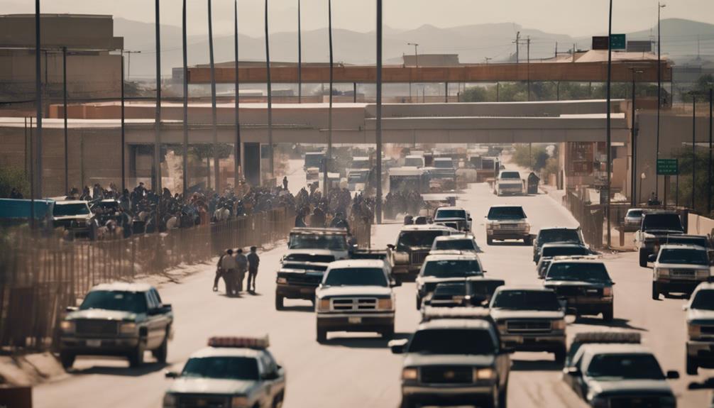
Border policies at the U.S.-Mexico border have evolved substantially over the years to address security and immigration challenges. One significant change was the Secure Fence Act of 2006, which authorized the construction of up to 700 miles of border barriers. These barriers, which vary in height from 18 to 27 feet, aim to reduce unauthorized migrant crossings and enhance border security.
Initially, there was a push to test a virtual fence before committing to physical barriers. However, priorities shifted towards tangible structures. By 2011, the Department of Homeland Security reported having 649 miles of barriers, an effort further extended by the Trump administration, which added an additional 52 miles.
Recently, the Biden administration announced plans to fill gaps in Arizona near Yuma, responding to a surge in migrant crossings. This move signifies a shift in border policies to address immediate logistical issues while balancing humanitarian concerns.
The continuous adaptation of border policies shows a dynamic approach to evolving challenges. Whether through physical barriers or policy adjustments, efforts to manage the border reflect ongoing debates and priorities in U.S. immigration strategy.
Environmental Impact
Construction of physical barriers along the Mexico-U.S. border has disrupted sensitive ecosystems and wildlife migration patterns. These barriers have caused habitat fragmentation, making it harder for species to thrive. Sensitive ecosystems like the Lower Rio Grande Valley National Wildlife Refuge in Texas have been especially impacted, threatening endangered species and biodiversity.
Take into account the following environmental impacts:
- Wildlife Migration Patterns: Species such as jaguars, ocelots, and bighorn sheep find their traditional routes blocked, causing population declines and genetic isolation.
- Habitat Fragmentation: Continuous barriers slice through natural habitats, splitting ecosystems into smaller, isolated patches. This fragmentation makes it difficult for animals to find mates, food, and shelter.
- Altered Water Flow: Flood control structures and other barriers change the natural flow of rivers and streams, affecting the local flora and fauna in riparian zones.
- Soil Erosion and Habitat Destruction: Construction activities and the presence of barriers disturb the soil, leading to erosion and loss of vegetation, which further impacts wildlife.
These border security measures pose a challenge to conservation efforts, making it essential to take into account both security and environmental sustainability.
Humanitarian Issues

Humanitarian issues along the Mexico-U.S. border have reached alarming levels, with over 2,000 migrant remains discovered between 2001 and 2012. This stark number highlights a severe human rights crisis that affects countless people.
Limited healthcare access in the border region exacerbates the situation, increasing the risks for contagious diseases like tuberculosis and Zika. Many individuals and families lack access to primary, preventive, and specialty medical care, leading to a significant impact on overall community well-being.
In addition to the immediate health risks, the border area experiences higher rates of chronic conditions such as obesity and diabetes. Women in this region face greater incidences of cervical cancer and a higher likelihood of caesarian section deliveries, which underscores the deficiencies in the healthcare infrastructure.
These disparities between border and non-border areas contribute to worsened health outcomes for people living near the border.
To address these humanitarian issues, it’s important to improve healthcare infrastructure, ensure better access to medical services, and implement preventive measures. By focusing on these areas, we can start to mitigate the human rights crisis and improve the quality of life for those affected along the Mexico-U.S. border.
Frequently Asked Questions
What Is the Name of the Border Between Mexico and the United States?
You’re asking about the border’s name? It’s the Mexico-United States border. It holds historical significance, impacts wildlife habitats, and has a massive economic influence on trade and immigration policies between the two nations.
What Is the Border of Mexico to Usa?
You’re asking about the border. It’s a complex area with significant environmental impact, crucial for border security, and a hub for cultural exchange. It’s a space where diverse issues converge, shaping both nations’ futures.
Which U.S. City Is Closest to the Mexico Border?
San Diego is the U.S. city closest to the Mexico border. You’ll see significant cross-border culture, economic impact, and immigration policies at play here, given its proximity to Tijuana and the bustling San Ysidro Port of Entry.
What Are the Ports of Entry Between the U.S. and Mexico Border?
You’ll find over 40 ports of entry that are essential for economic impact, border security, and cultural exchange. These ports facilitate trade, tourism, and immigration, making them indispensable connectors between nations, enhancing both economies and communities.
Conclusion
You’ve explored the intricate geography, rich history, and numerous checkpoints along the Mexico-U.S. border.
You’ve seen how security measures aim to balance immigration enforcement with environmental and humanitarian concerns.
Understanding these complexities helps you appreciate the ongoing challenges and efforts on both sides.
As you consider this border, remember it’s more than a line; it’s a dynamic region with profound impacts on communities, policies, and lives.